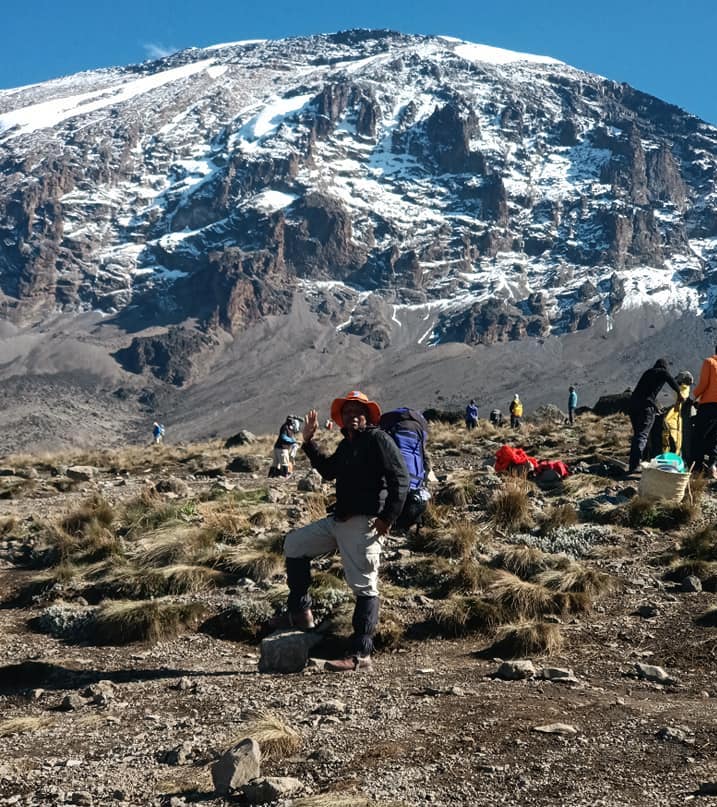
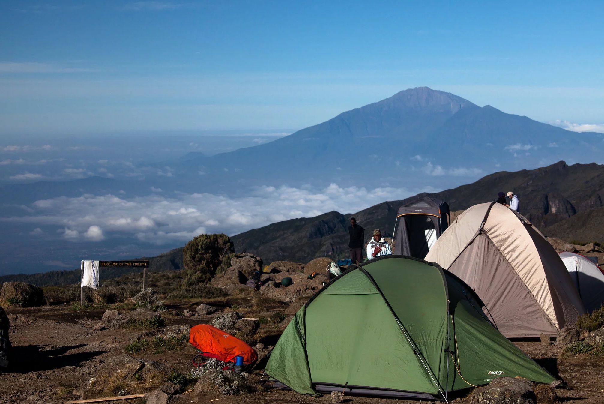
The Shira Route was originally the Lemosho route, and that is why their itineraries are identical. The Lemosho Route was created to improve the starting point of hiking for trekkers since the Shira Route hike starts at 3600 meters, which is not ideal for hikers as it causes altitude sickness. Approaching the mountain from the west side, The Shira Route hike starts with a drive from Moshi to Shira Ridge, passing through the forest zone. The hike starts from Shira Ridge and continues through Shira Plateau, circling the Southern Circuit before getting to Barafu Camp for the summit hike. Descending the hike is done using the Mweka route.

The Shira Route is less used due to its high starting altitude; it’s similar to the Lemosho route, has beautiful scenery, and hikers tend to get altitude sickness-related symptoms in the first place. The Shira Route can be hiked in either 7 days or 8 days, with the extra day on the 8-day itinerary being spent at the Moir Hut for better acclimatization on day three.
Arrival into Kilimanjaro Airport - Transfer to Moshi
You will be picked up from the airport by our guide and driven to your hotel, where you will spend the night. After settling in, the guide will then check the equipment to make sure that it is in place and in good condition, and a briefing for the next day and what to expect during the climb will also be carried out.
Morum Barrier (Shira Gate) to the Simba Camp
Zone: Heath zone
Elevation: 3414 m to 3500 m
Duration: 2 hours
Distance: 4 km
We drive from Moshi to the Londorossi Gate for about four hours and then sign in at the gate to get the hiking permits. After all the formalities are completed with the authorities, porters, and guides getting ready, we continue to drive on a steep path to the Shira Gate, where the hike officially begins. The hike will take you through the heath zone with giant shrubs until we get to Simba Camp, where we spend our first night on the mountain.
Simba Camp to Shira Camp 2
Zone: health zone
Elevation: 3505 m to 3847 m
Duration: 4 to 5 hours
Distance: 6km
After breakfast, we continue our hike eastward, crossing the Shira Plateau and hiking past the Shira Plateau towards Shira 2 Camp, where we will spend our second night on Mount Kilimanjaro.
Shira 2 Camp, Lava Tower, and Barranco Camp
Day 3 always consists of two parts: the first is the hike to Lava Tower for acclimatization, and the second is the descent to Barranco Camp following the climb high and sleep low strategy.
Part 1: Shira 2 Camp-Lava Tower
Elevation: 3847 m to 4630 m
Duration: 4 to 5 hours
Distance: 7 km.
The first part of the hike starts from Shira 2 camp and goes to the rock formation known as the lava tower,” which is found at 4630m above sea level. It will take you about 4 to 5 hours, and most tourist operators serve lunch at the Lava Tower before continuing with the hike.
Part 2: Lava Tower-Barranco Camp
Zone: Alpine desert
Elevation: 4630 m to 3976 m
Duration: 2 to 3 hours
Distance: 3 km
After the short rest at the Lava Tower, we continue our hike while descending to the Barranco camp, which is found just below the Barranco Wall and the Western breach, and this will take about three to four hours.
Barranco , hike to Karanga Camp
Zone: Alpine Desert
Elevation: 3976 m to 3995 m
Duration: 4 to 5 hours
Distance: 5 km
The fourth day will take you to the famous Barranco Wall, which is quite intimidating at first, although after attempting the hike, hikers have said it is an easy climb. After conquering the Barranco Wall using both hands and feet to keep steady, the top of the wall is an easier hike where you get to see the first views of the southern ice fields before descending to the Karanga Camp.
Karanga Camp to Barafu Camp
Zone: Alpine Desert
Elevation: 3995 m to 4673m
Duration: 3 hours
Distance: 4 km
We set off from Karanga Camp after breakfast and hiked till we got to the junction that connected with the Mweka trail. After the Mweka trail, we continue to Barafu Hut and complete the hike around the Southern Circuit. We rest at the Barafu camp as we fully prepare for the summit day.
Barafu Camp to the Summit - Descend to Mweka Camp
This is the summit day, the day that we have all been waiting for, and it is divided into two parts: Barafu to Uhuru Peak and Uhuru Peak to Mweka.
Part 1: Barafu-Uhuru
Zone: Arctic
Elevation: 4673 m to 5895 m
Duration: 7 to 8 hours
Distance: 5 km
The hike from Barafu to Uhuru starts between midnight and 2:00 a.m. after a light breakfast. You will need to have lots of layers of clothes because of the cold and a headlamp since it will be very dark. The hike will take you northwestwards, where you have to walk slowly and carefully, and in about 6 to 7 hours, you will reach Stella Point, which is found at the crater rim at 5685m above sea level. Hikers rest a bit and enjoy the sunrise at Stella Point, and for those who can’t continue with the hike to Uhuru, turn back at this point (hikers are still given certificates of participation at this point), and you will have roughly an hour or two to get to Uhuru Peak.
Uhuru Peak is the highest point in Africa, at 5895m above sea level. A big sign welcomes you to the peak fully covered in snow, where we get to see the different magnificent views, take photos, and celebrate before the descent begins.
Part 2: Uhuru-Mweka
Zone: Arctic
Elevation: 5895 m to 3068 m
Duration: 4 to 6 hours
Distance: 12 km.
After the celebrations, the descent to Mweka camp begins. We make a stopover at the Barafu camp for lunch before continuing to Mweka Camp for our last night on the mountain but note that the mountain is rocky and slippery, and you will have to use walking sticks and gaiters.
Mweka camp to Mweka gate. Transfer to Moshi / Arusha
Zone: Rainforest
Elevation: 3068 m to 1640 m
Duration: 3 hours
Distance: 10km
This is the last day on Mount Kilimanjaro, and we hike on foot till we get to Mweka Gate, where a guide will be waiting to take us back to the hotel.
Prices for 7 Days Kilimanjaro Hike through Shira Route


Tour Reviews
There are no reviews yet.
Leave a Review